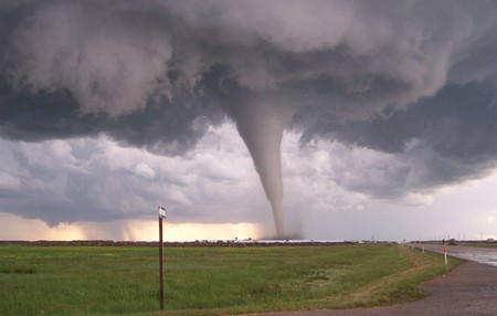
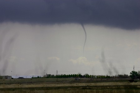
The term tornado is defined as a violent storm with very strong winds which move in a circle. Tornadoes are basically a vertical column of air which is narrower at the bottom and wider at the top with dense heavy clouds. A tornado revolves counterclockwise at a very high speed. All the true tornadoes have one characteristic in common that all of them appear to us like a condensed funnels. These funnels are surrounded by clouds of debris or dust. The swirl of a tornado is formed because of immense energy transformations.
Tornadoes are formed in several different shapes and sizes. A tornado can have shapes that range from a rope-like structure to fat cylinders or even in conical or wedge-shaped structures. Following are mentioned some of the different types of true tornadoes along with some cousins of tornadoes including, dust devil, gustnado and firewhirl. These are called cousins of tornadoes because of their structures.
Supercell Tornadoes
Supercell thunderstorms are accountable for giving rise to a number of most tremendous tornadoes. A supercell thunderstorm is normally a long-lasting thunderstorm having a constant spinning updraft of air within itself. These thunderstorms are pretty much capable of producing violent tornadoes with a huge wedge shaped structure. A low-hanging, rotating layer of cloud called wall cloud is produced with supercell thunderstorms. It has been noted that one side of the wall cloud is absolutely free of rain while the other has dense shafts of rain. The updraft air that is seen on the radar is given the name of mesocyclone.
Most of the tornadoes formed from supercell thunderstorms normally remain connected to the ground for fairly longer period of times, i.e. an hour or more. These tornadoes are vicious having winds surpassing 200 mph.
Landspout
Landspout are the tornadoes which are lesser in their intensity than supercell tornadoes. These types of tornadoes usually do not represented by wall cloud or mesocyclone. Landspout can often be seen under the cumulonimbus or towering cumulus clouds. These are formed in the direction of the leading edge of rain-cooled downdraft air emerged from a thunderstorm called gust front.
Gustnado
Gustnado is a type of tornado which is weaker and usually persists for shorter period of time. They normally form in the direction of the gust front of a thunderstorm and looks like a temporary dust whirl or debris cloud.
Waterspout
These are the tornadoes which are formed over the water that is why these are called waterspout. There can be different factors involve in the formation of waterspout, i.e. some of them are formed from supercell thunderstorms, while other are formed from the weak thunderstorms or rapidly growing cumulus clouds. They are not violent and far less destructive with their fifty yard width. These tornadoes normally appear over the warm tropical ocean waters. Funnel is composed of freshwater droplets.
Following two are the cousins of the tornadoes:
Dust Devils
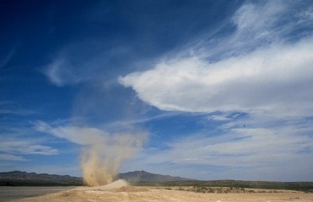
Dust devils are normally appeared in the hot, dry clear days on the desert or over dry land. Late morning or early afternoon of the hot sunny day often results in dust devils. Light desert breeze is responsible for triggering the whirlwinds with winds exceeding 70 mph. As these are not formed because of the thunderstorm, so they are not categorized as true tornadoes. Most of the dust devils are short lived, i.e. remain for few minutes; however, these can remain for longer periods of time as well. Though harmless at most of the times, they can blow the vehicles off and can harm your eyes by blowing dust into them.
Firewhirls
Firewhirls are usually formed as a result of extreme heat produced by major forest fire or volcanic eruptions. These are called firewhirls because of having a tornado-like structure of spinning column of smoke or fire. In firewhirls, the winds normally exceed 100 mph. The other names given to firewhirls are firenadoes, fire, tornadoes, or fire devils.


